Utah hiking trails
Slot canyons, arches, waterfalls, alpine lakes and the state's highest peak.
Find a Utah hike that fits your day. Compare the listed distance, climb, terrain and seasonal notes, then open the managing agency's trail information before you set out. Use the filters to narrow the choices, but read each route's notes: a short walk can still involve steep steps, exposure or difficult footing.
- Zion National Park · Southern Utah
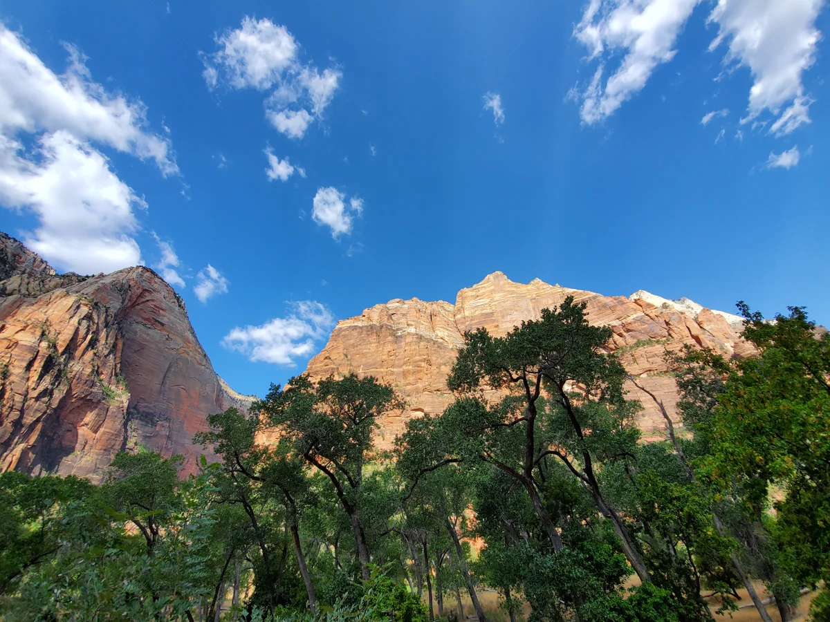 “Riverside Walk, The Gateway to the Narrows, Zion National Park”. File photo, 2019-09-11. Photo: John Manard · CC BY-SA 2.0 · Wikimedia Commons
Riverside Walk
- Easy
- Dogs prohibited
2 miles round trip (1 mile each way)Year-round; winter ice can close sections
From the Temple of Sinawava, this paved path follows the Virgin River toward The Narrows. Turn around where the pavement ends for a walk without entering the river. The first half-mile is mostly flat, but irregular paving, steeper sections and minor drop-offs mean it is not uniformly level.
- Zion National Park · Southern Utah
 “Sunrise on Angels Landing, Zion NP 2014”. File photo, 2014-05-01. View from the approach trail. Photo: Don Graham · CC BY-SA 2.0 · Flickr
Angels Landing
- Very hard
- Dogs prohibited
5.4 miles round trip from the GrottoClimb 1,488 ftMarch to November; icy in winter
From the Grotto shuttle stop, switchbacks and the tight turns of Walter’s Wiggles climb to Scout Lookout, then a narrow fin of sandstone with chains and sheer drops leads to the summit. The Park Service says most hikers take about four hours. Scout Lookout makes a turnaround for anyone without a permit or uneasy with heights.
Permit: A permit from the Park Service lottery on Recreation.gov is required for the chains section beyond Scout Lookout. Hiking to Scout Lookout needs no permit.
- Zion National Park · Southern UtahThe Narrows, Zion National Park. File photo, NPS asset create date May 15, 2012. Photo: NPS Photo · Public domain · National Park Service
The Narrows
- Hard
- Dogs prohibited
Up to about 9.4 miles round trip bottom-up to Big Spring; 16 miles one way top-downClimb About 350 ft bottom-upLate spring to fall, when flows are low; drysuits make winter trips possible
You hike in the Virgin River itself, between walls about 1,000 feet tall that close in to 20 or 30 feet apart. Most people walk the paved, 1-mile Riverside Walk from the Temple of Sinawava, then wade upstream and turn around whenever they like. The Park Service says at least 60% of the hike is spent in cold, fast water on slippery boulders, and calls it strenuous.
Permit: Bottom-up hikes as far as Big Spring need no permit. Top-down trips from Chamberlain’s Ranch need a wilderness permit. The park closes The Narrows when flow tops 150 cubic feet per second and during flash flood warnings; check its conditions page and the flash flood forecast first.
- Zion National Park · Southern Utah
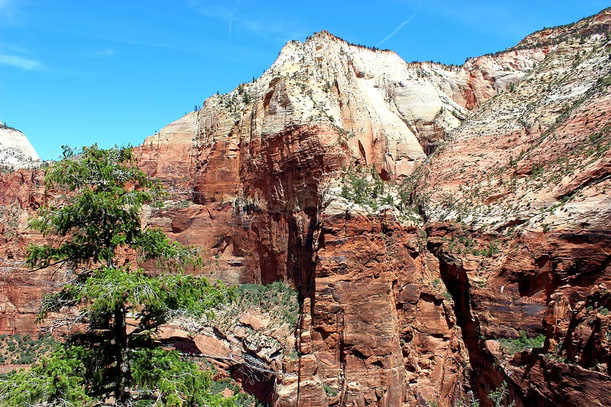 File photo. Photo: Aaron Zhu · CC BY-SA 3.0 · Wikimedia Commons
Observation Point via East Mesa
- Moderate
- Dogs prohibited
About 7 miles round tripClimb About 700 ftMay to October; the access road can be muddy or snowy
Observation Point looks straight down Zion Canyon, and from above Angels Landing. Since rockfall closed the old route from Weeping Rock, hikers reach it across the forested East Mesa from a trailhead outside the park’s east side, which makes it a mostly flat walk with a huge finish.
- Zion National Park · Southern Utah
 Canyon Overlook / Mount Carmel Highway area, Zion National Park, Utah. File photo, 2014-04-30. Photo: Don Graham · CC BY-SA 2.0 · Flickr
Canyon Overlook Trail
- Easy
- Good for kids
- Dogs prohibited
About 1 mile round tripClimb About 160 ftYear-round
A short, ledgy trail just east of the Zion–Mount Carmel Tunnel that ends at a view down Pine Creek to lower Zion Canyon. Railings cover most of the drop-offs, and it is a good sunrise or sunset walk for families.
- Bryce Canyon National Park, off SR-12 · Southern Utah
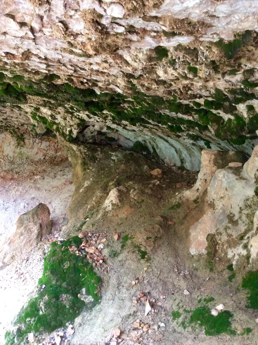 “Mossy Cave in Bryce Canyon National Park”. File photo, 2016-06-11. Photo: Amymcools · CC BY-SA 4.0 · Wikimedia Commons
Mossy Cave
- Easy
- Dogs prohibited
0.8 mile round tripClimb 150 ftYear-round; check winter conditions
A streamside trail reaches a mossy grotto in the northern part of the park, outside the main entrance road. Keep proof of park admission in your vehicle. If the designated lot is full, return later: parking on SR-12 is prohibited. The unpaved trail is not wheelchair accessible.
- Bryce Canyon National Park, Rainbow Point · Southern Utah
Bristlecone Loop
- Easy
- Dogs prohibited
1 mile loopClimb 200 ftSpring to fall; deep winter snow can make the trail inaccessible
Walk through high-elevation forest and bristlecone pines near Rainbow and Yovimpa points at the southern end of the park. The loop reaches above 9,100 feet and offers long views. Its easy rating describes a short hike, not a paved or wheelchair-accessible route; the park shuttle does not serve this trailhead.
- Capitol Reef National Park · Central Utah
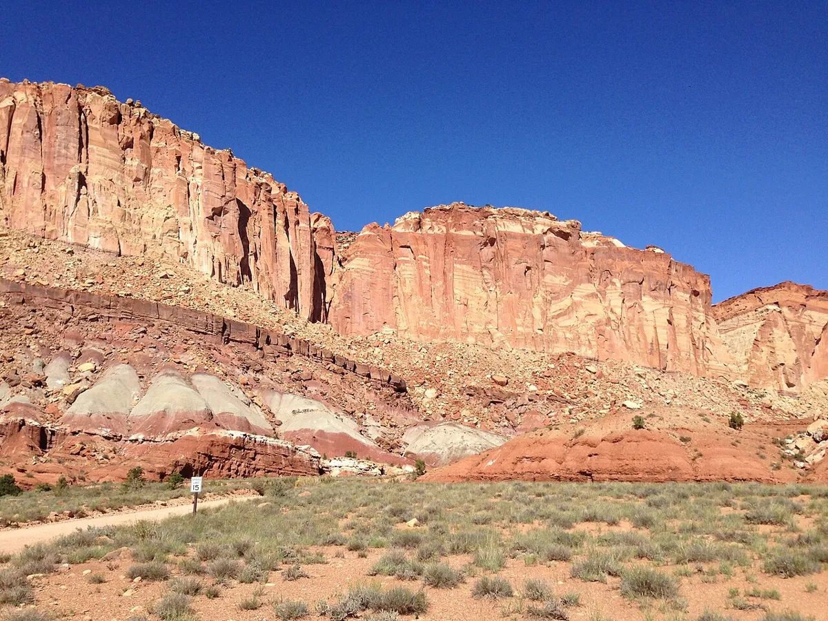 File photo. Photo: Famartin · CC BY-SA 3.0 · Wikimedia Commons
Grand Wash
- Easy
- Dogs prohibited
4.4 miles round trip (2.2 miles each way)Climb 200 ft elevation change, per the park trail guideSpring and fall; avoid summer heat and threatening storms
A mostly level canyon-bottom walk through high sandstone walls and narrows. The park rates it easy, but the ground is uneven and flash flooding is a serious hazard. Do not enter when storms threaten, and check road conditions before approaching from the Scenic Drive.
- Capitol Reef National Park · Central Utah
 File photo. Photo: Chris Light · CC BY-SA 4.0 · Wikimedia Commons
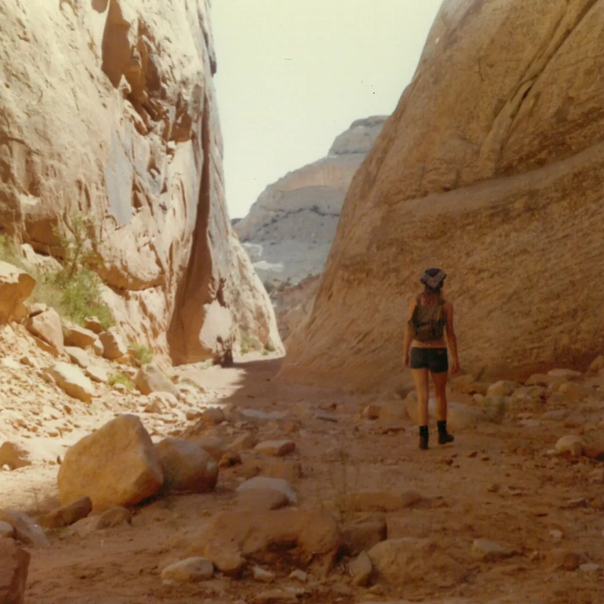
Capitol Gorge
- Easy
- Dogs prohibited
2 miles round trip (1 mile each way)Climb 80 ft elevation change, per the park trail guideSpring and fall; avoid summer heat and threatening storms
Follow a narrow canyon past historic inscriptions, with a short climb toward waterpockets known as the tanks. Check the access road before setting out, stay out of the gorge when storms threaten, and do not swim in the waterpockets.
- Capitol Reef National Park · Central Utah
 File photo. Photo: Frank Kovalchek · CC BY 2.0 · Wikimedia Commons
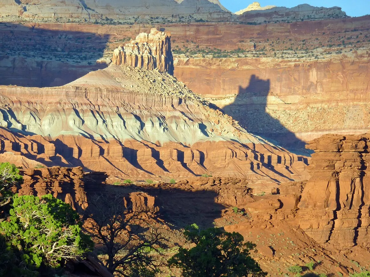
Sunset Point
- Easy
- Dogs prohibited
0.8 mile round trip (0.4 mile each way)Climb Less than 50 ft elevation change, per the park trail guideSpring and fall; summer heat and winter weather require planning
A short, uneven but mostly level walk to a panorama of Capitol Reef. The park recommends it for sunset views. Carry water even on this brief outing, and allow enough time for the return walk.
- Bryce Canyon National Park · Southern Utah
 File photo. Photo: Fabio Achilli · CC BY 2.0 · Wikimedia Commons
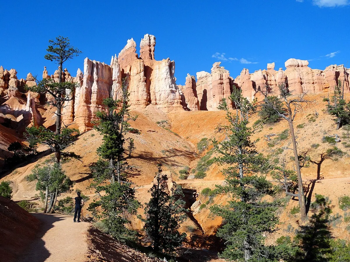
Queens Garden and Navajo Loop
- Moderate
- Dogs prohibited
2.9 miles loopClimb 625 ftYear-round; Wall Street closes in winter
The park’s most popular hike and the one it recommends to first-time visitors: down Queen’s Garden from Sunrise Point among orange hoodoos, up the Navajo Loop switchbacks to Sunset Point, and back along the rim. The Park Service recommends hiking it clockwise. In winter, when Wall Street is closed, use the Two Bridges side.
- Bryce Canyon National Park · Southern Utah
 File photo. Photo: Ken Lund · CC BY-SA 2.0 · Wikimedia Commons
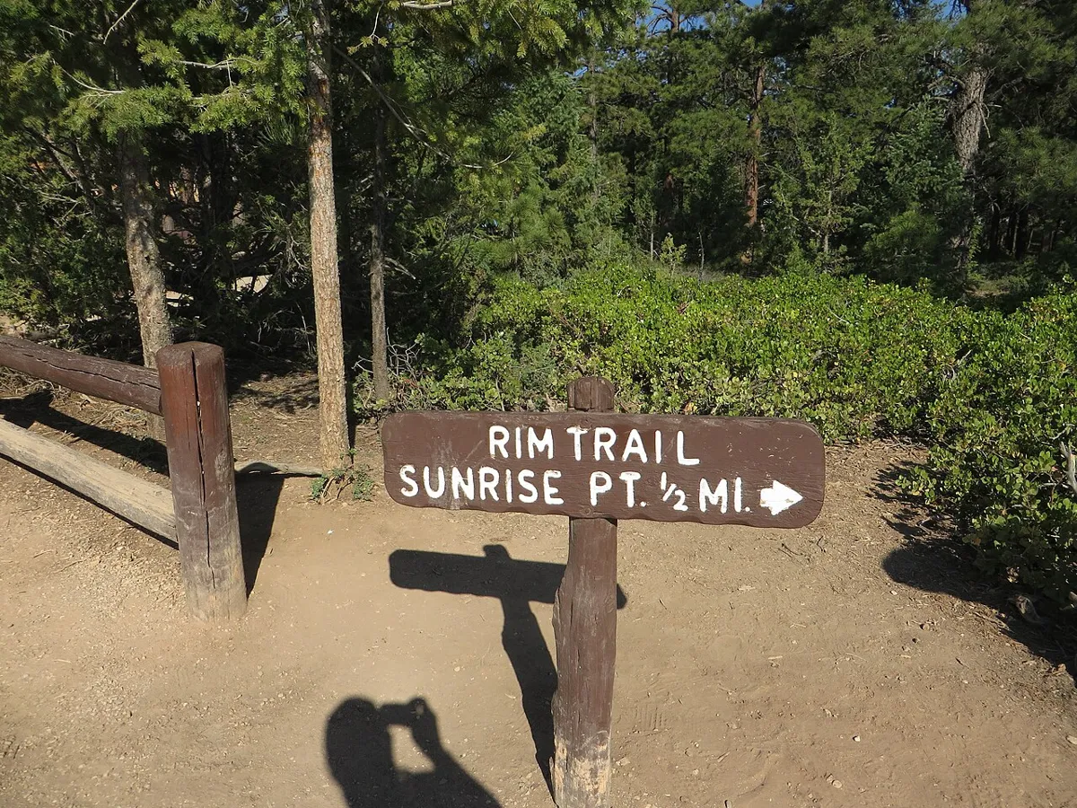
Sunset Point to Sunrise Point
- Easy
- Good for kids
- Dogs allowed
1 mile round tripClimb 40 ftYear-round; snow and ice in winter
The only paved section of the Rim Trail, along the edge of the Bryce Amphitheater between Sunset and Sunrise points, with the hoodoos below. The Park Service calls it the easiest walk in the park and lists it as accessible. The shuttle can bring you back if you only want to walk one way. Leashed pets are allowed on the pavement.
- Bryce Canyon National Park · Southern Utah
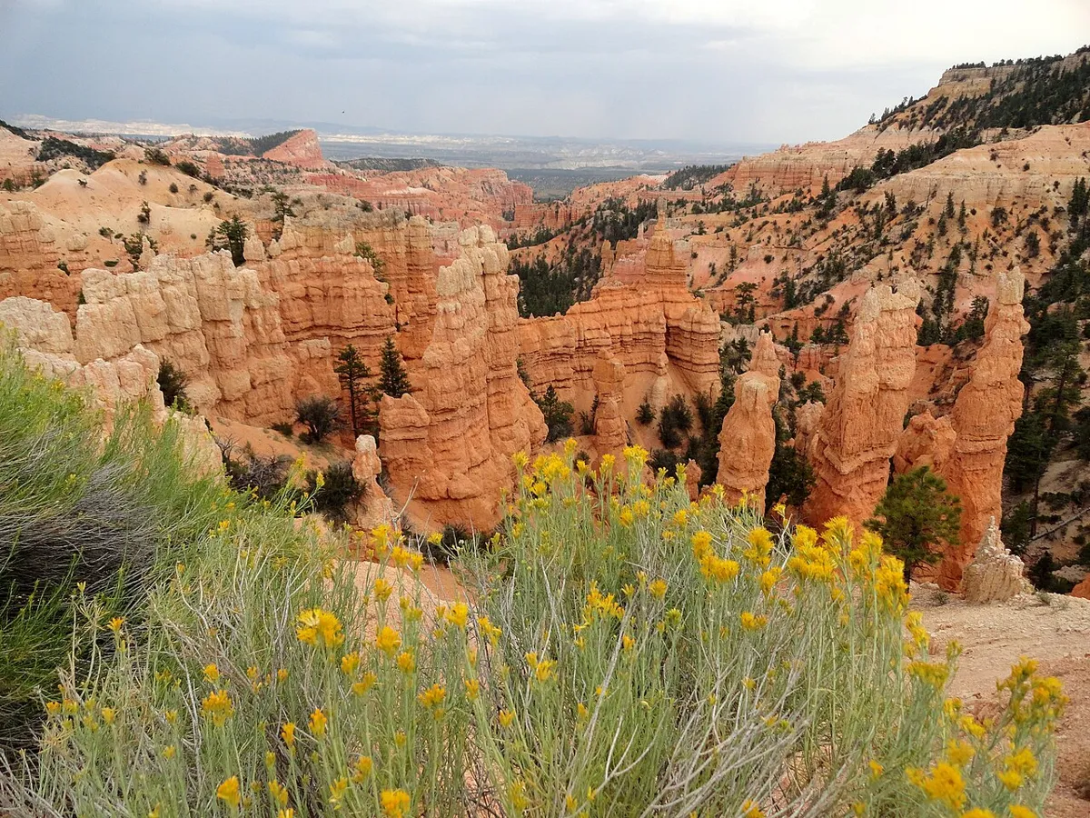 File photo. Photo: Fabio Achilli · CC BY 2.0 · Wikimedia Commons
Fairyland Loop
- Hard
- Dogs prohibited
About 8 miles loopClimb About 1,700 ftMay to October
Bryce’s best long day hike drops off the rim into fins, windows and towers that see far fewer people than Sunset Point, passes Tower Bridge and climbs back up along the rim. It is a lot of up and down at 8,000 feet.
- Grand Staircase-Escalante National Monument · Southern Utah
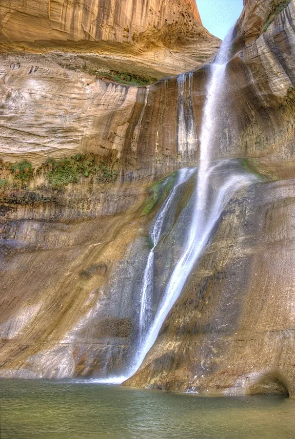 “Lower Calf Creek Falls”. File photo, September 26, 2011. Photo: John Fowler · CC BY 2.0 · Wikimedia Commons
Lower Calf Creek Falls
- Moderate
- Dog policy not recorded
6 miles round tripClimb About 250 ftYear-round; hot in midsummer
A developed trail from the Calf Creek campground follows the creek past pictographs and granaries to a 126-foot, spring-fed waterfall. The BLM rates it moderately difficult because of sandy stretches, warns that it can be hot in summer, and requires hikers to carry out all solid human waste in bags.
- Capitol Reef National Park · Central Utah
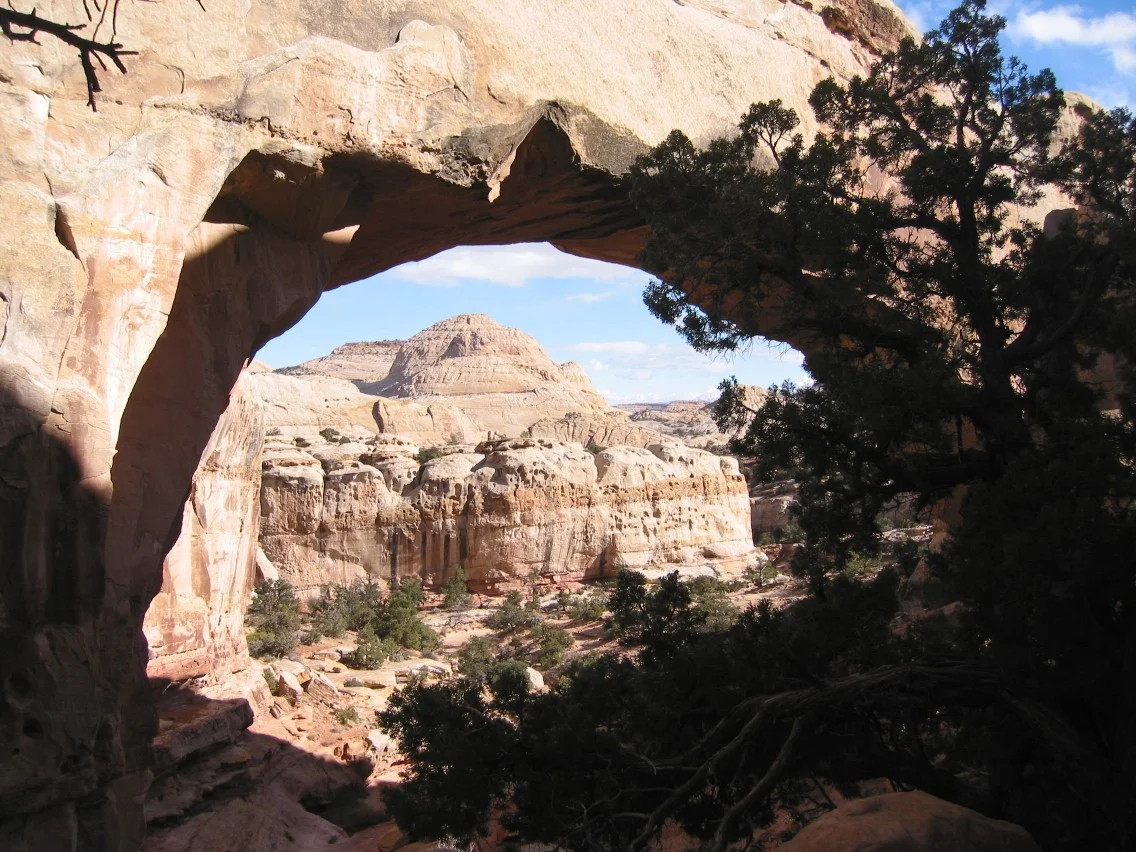 “Capitol Reef - Hickman Bridge”. File photo, 2004-10-31. Photo: Bob Palin · CC BY-SA 2.0 · Wikimedia Commons
Hickman Bridge
- Moderate
- Dogs prohibited
About 1.8 miles round trip (0.9 mile each way)Climb About 400 ftYear-round; hot in summer
A climb above the Fremont River to a 133-foot natural bridge, with a trail that goes under and around it. The park rates it moderate, a mix of steep grades and level sections, and notes that many trailheads start around 5,000 feet and fill by 9 a.m.
- Capitol Reef National Park · Central Utah
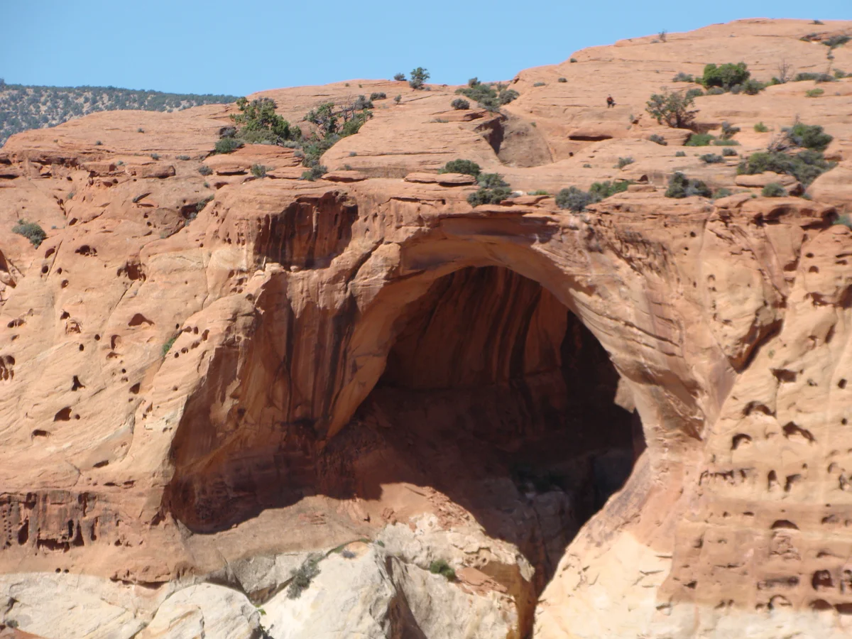 “View of Cassidy Arch (980fa91f-de52-4028-9964-542262682336)”. File photo, 2015-06-02. No claim to original U.S. Government works. Photo: National Park Service · Public domain · Wikimedia Commons
Cassidy Arch
- Hard
- Dogs prohibited
About 3.4 miles round trip (1.7 miles each way from the Grand Wash trailhead)Climb 670 ft elevation change, per the park trail guideMarch to November
From the Grand Wash trailhead, the trail climbs the canyon’s north wall onto slickrock above an arch named for the outlaw Butch Cassidy, who is thought to have hidden in Grand Wash. The park rates it strenuous: steep grades, uneven terrain and long, steady climbs. Cairns mark much of the way.
- Kanarraville, near Cedar City · Southern Utah
Kanarra Falls
- Moderate
- Dog policy not recorded
About 3.8 miles round trip to the last waterfallLate spring to fall; cold water
An old road leads into the Hurricane Cliffs, then the route follows the creek into a slot canyon, alternating between trail and shallow water. At the first big waterfall, about 1.6 miles in, a 20-foot ladder climbs past it; beyond that the route is not maintained, and the town says to go no farther than the final waterfall at about 1.9 miles, where private property begins. It warns that snowmelt can raise the water quickly from mid-April through May.
Permit: A ticket from the Town of Kanarraville is required, with a limit of 200 general admission tickets a day. Weekends in spring and summer often sell out weeks ahead. Buy at kanarrafalls.com.
- Snow Canyon State Park · Southern Utah
Lava Flow Trail and Lava Tubes
- Moderate
- Dogs prohibited
2.5 miles round tripOctober to May; hot in summer
A trail across a 27,000-year-old lava flow dotted with cactus and yucca, passing the entrances to two lava tubes you can explore, with sandstone cliffs all around. State Parks rates it moderate for its uneven rock and says to bring a flashlight to enter the tubes; glow sticks are not allowed.
- Red Cliffs National Conservation Area, near Leeds · Southern Utah
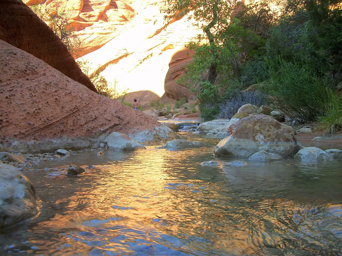 File photo. Photo: The Dye Clan · CC BY-SA 3.0 · Wikimedia Commons
Red Reef Trail
- Easy
- Good for kids
- Dog policy not recorded
About 2 miles round tripClimb About 300 ftOctober to May
A creekside path from the Red Cliffs campground into a red sandstone gorge with small waterfalls and pools. A short scramble up steps carved into the rock adds an adventure kids love.
- Natural Bridges National Monument · Eastern Utah
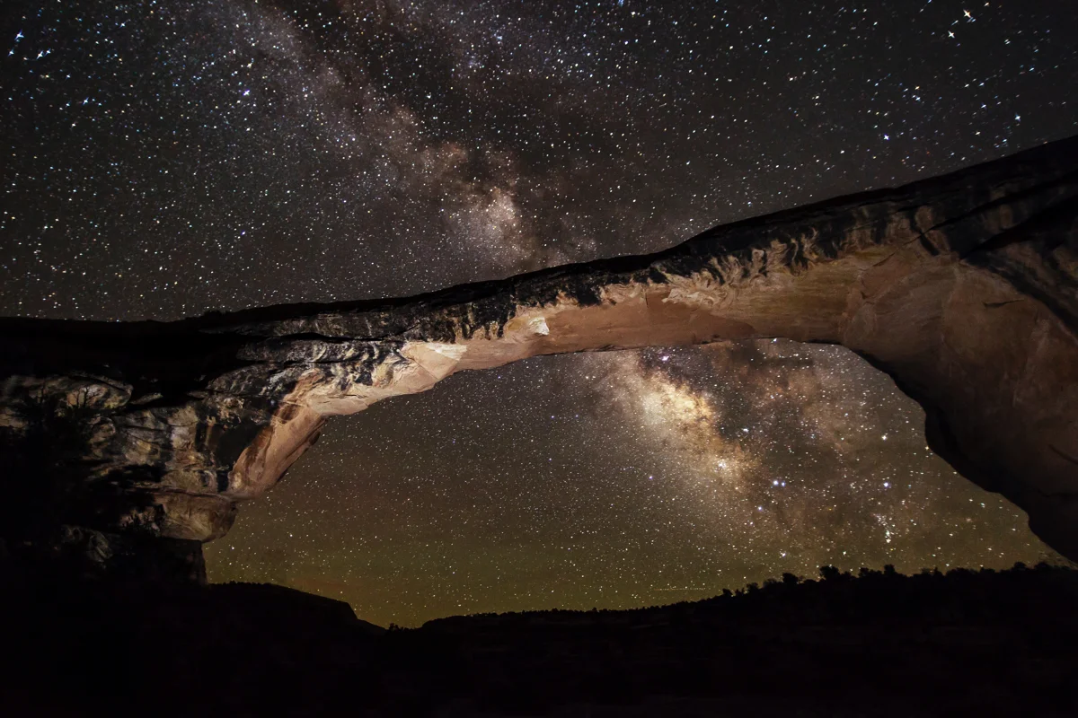 “Night sky at Owachomo Bridge”. File photo, 2013-05-10. Night view. No claim to original U.S. Government works. Photo: NPS / Jacob W. Frank · Public domain · Wikimedia Commons
Owachomo Bridge
- Moderate
- Dogs prohibited
0.5 mile round tripSpring and fall recommended; summer heat and winter ice require care
An unpaved trail descends 188 feet to the bridge’s base using wooden and rock steps, then returns uphill. This is a different outing from the short paved viewpoint walk and is not wheelchair accessible. Fill water at the visitor center before starting; there is none at the trailhead.
- Natural Bridges National Monument · Eastern Utah
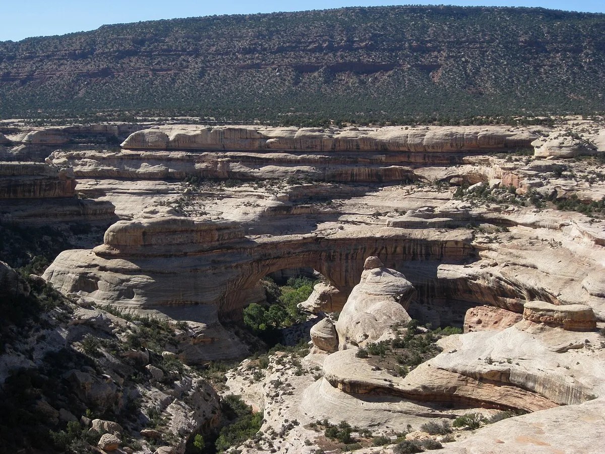 File photo. Photo: brewbooks · CC BY-SA 2.0 · Wikimedia Commons
Sipapu Bridge
- Hard
- Dogs prohibited
1.4 miles round tripSpring and fall recommended; winter conditions can be treacherous
Start at the Sipapu Bridge Trailhead, not the separate viewpoint lot. The strenuous route drops 436 feet toward the bridge using three wooden ladders, a long metal staircase and rock steps before the climb back. The north-facing trail can hold ice; it is not wheelchair accessible.
- Natural Bridges National Monument · Eastern Utah
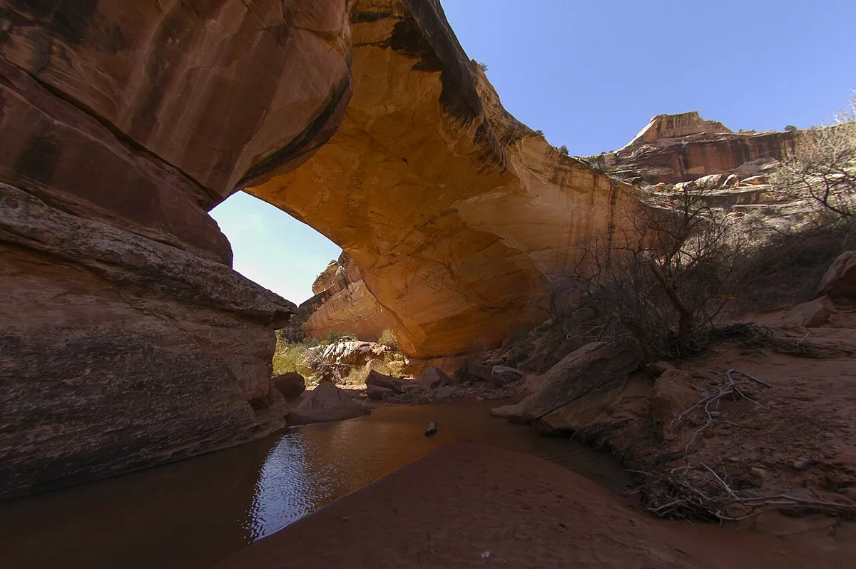 File photo. Photo: Natural Bridges National Monument · CC BY 2.0 · Wikimedia Commons
Kachina Bridge
- Hard
- Dogs prohibited
1.4 miles round tripSpring and fall recommended; winter snow and ice can make the descent hazardous
From the paved viewpoint approach, take the primitive trail down to the bridge. The park calls this strenuous: a 462-foot descent involves a wooden ladder, stairs and switchbacks, followed by the return climb. View the petroglyphs without touching them. A pit toilet is at the parking area; drinking water is at the visitor center.
- Hovenweep National Monument · Eastern Utah
 File photo. Photo: Chris M Morris · CC BY 2.0 · Wikimedia Commons
Square Tower Group Loop
- Moderate
- Dogs allowed
2 miles loopYear-round, daylight only; little shade and possible winter ice
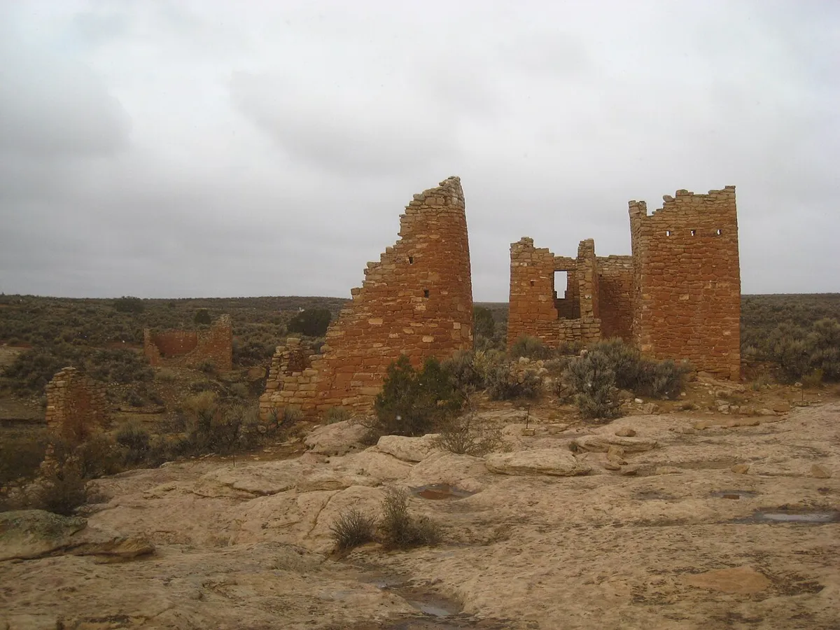
From the visitor center, circle Little Ruin Canyon past ancestral Puebloan structures. The full loop leaves the paved overlook approach and crosses the canyon with an 80-foot descent and climb on stairs; it is not wheelchair accessible. Stay on the marked trail, do not touch or enter structures, and finish before sunset. Dogs must stay on a leash no longer than 6 feet.
- Goblin Valley State Park · Eastern Utah
Carmel Canyon Loop
- Moderate
- Dog policy not recorded
1.5 miles loopSpring and fall recommended; avoid canyons when rain threatens
A marked loop passes colorful narrows with views of Three Sisters and Molly’s Castle. Completing the loop involves rock scrambling; the connection to Goblin’s Lair is a separate extension. Check the flash-flood forecast before entering the canyon and skip canyon routes if rain is possible.
- Goblin Valley State Park · Eastern Utah
 File photo. Photo: cappellacci · CC BY 2.0 · Wikimedia Commons
Three Sisters
- Easy
- Dog policy not recorded
500 yards round trip (250 yards each way)Spring and fall recommended; summer heat and occasional winter snow
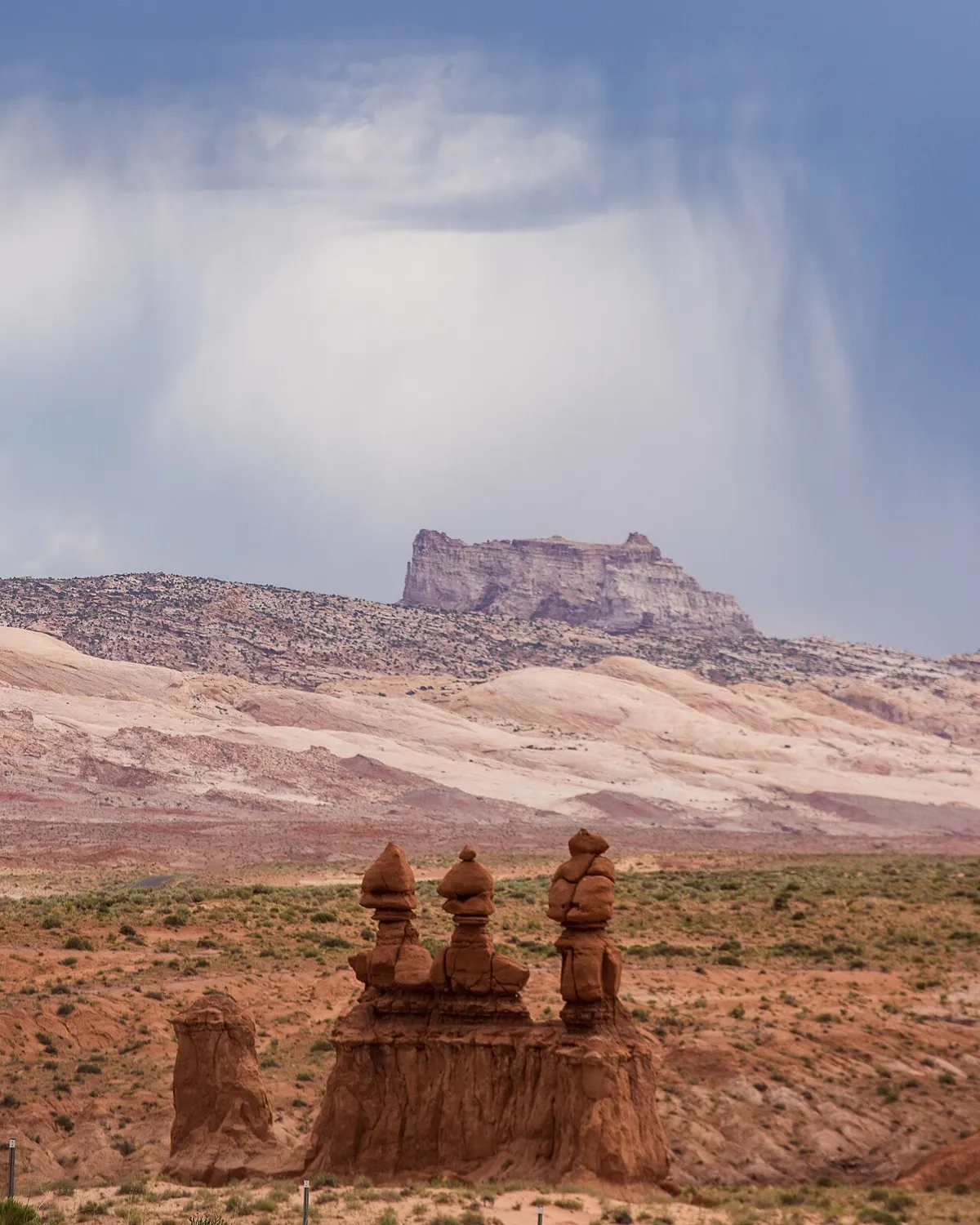
A short marked path from the observation-point road approaches one of the park’s best-known groups of goblin formations. Return the same way for this short outing; continuing beyond the formation drops into the Carmel Canyon trail system and changes the route. Do not climb or damage fragile formations.
- Canyonlands National Park, The Needles · Eastern Utah
 File photo. Photo: RuggyBearLA · CC BY 2.0 · Wikimedia Commons
Pothole Point
- Easy
- Dogs prohibited
0.6 mile loopClimb 36 ft elevation change, per the parkCheck seasonal conditions; snow and ice are possible in winter
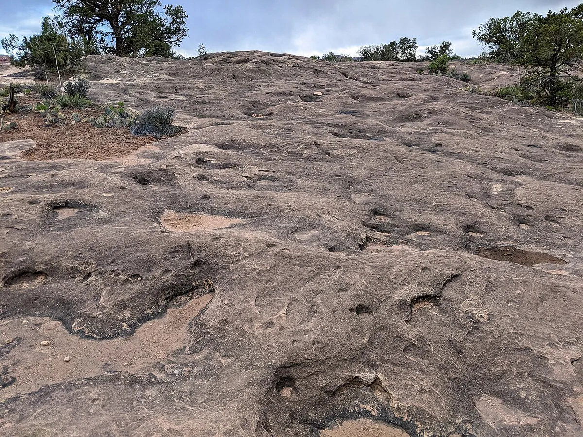
Follow cairns across uneven sandstone to views of The Needles and small rock basins that shelter desert life. Walk around potholes even when dry, and keep hands and feet out of them. The route includes rocky slopes and stone steps and is not wheelchair accessible.
- Canyonlands National Park, The Needles · Eastern Utah
 File photo. Photo: Tricia Simpson · CC BY-SA 3.0 · Wikimedia Commons
Cave Spring
- Easy
- Dogs prohibited
0.6 mile loopClimb 67 ft elevation change, per the parkCheck seasonal conditions; snow and ice are possible in winter
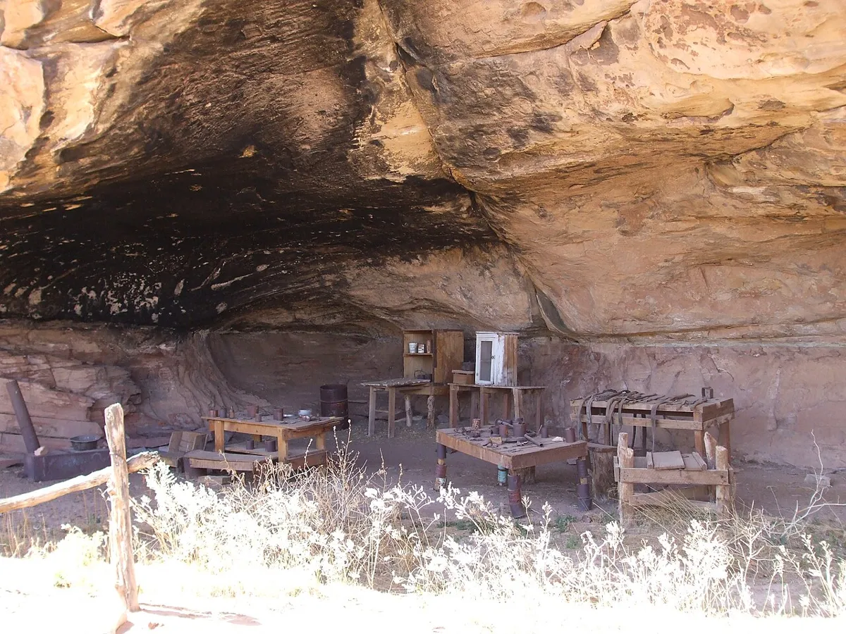
A short loop connects a historic cowboy camp and Indigenous rock markings, with two ladders to complete the route. Despite the easy rating, uneven rock and steps make this unsuitable for wheelchairs. Do not enter the spring, touch the markings or disturb structures and objects.
- Arches National Park · Eastern Utah
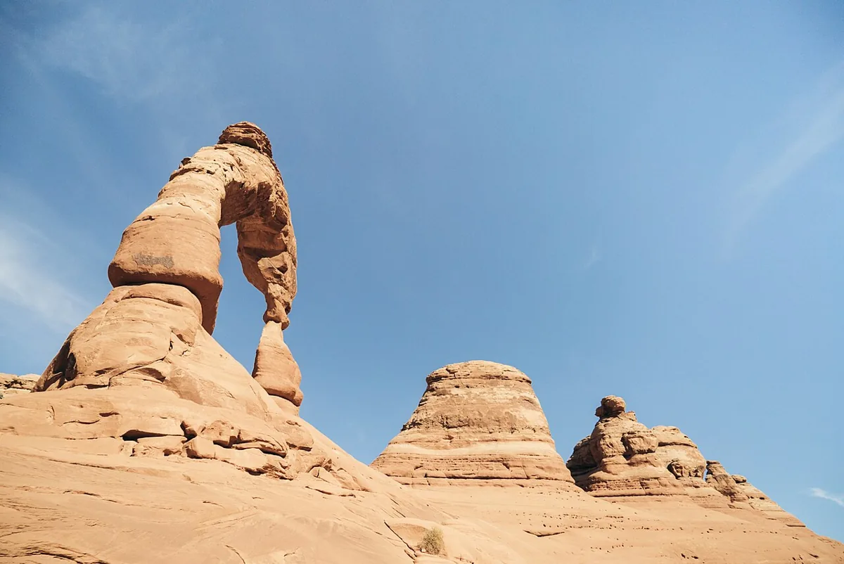 File photo, November 10, 2016. Photo: Adam Skalecki · CC0 · Wikimedia Commons
Delicate Arch
- Hard
- Dogs prohibited
3 miles round tripClimb 538 ftYear-round; avoid midday heat in summer
From Wolfe Ranch, the trail climbs a steep slickrock slope with no shade, then follows a narrow ledge for about 200 yards before the arch appears. The Park Service rates it strenuous, says to bring at least 2 quarts of water, and advises traction devices in winter, when the ledge is often icy. Sunset hikers need a light for each person.
- Arches National Park · Eastern Utah
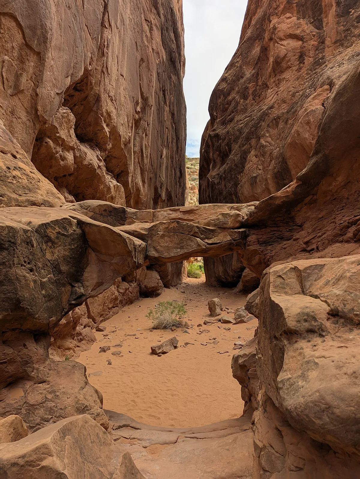 File photo. Photo: G. Edward Johnson · CC BY 4.0 · Wikimedia Commons
Fiery Furnace
- Hard
- Dogs prohibited
About 2 miles; no set trailSpring to fall
A maze of tight sandstone fins where you squeeze, scramble and chimney through passages with no marked trail. It is easy to get lost, which is why access is limited.
Permit: You need either a spot on a ranger-led hike or a self-guided permit, both booked through the park. Permit holders watch an orientation first.
- Arches National Park, Devils Garden · Eastern Utah
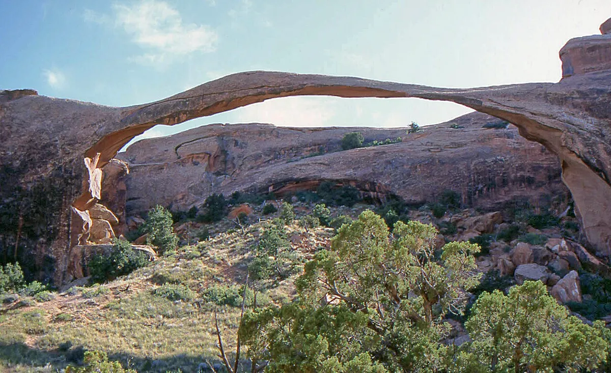 File photo. Photo: W. Bulach · CC BY-SA 4.0 · Wikimedia Commons
Landscape Arch
- Easy
- Good for kids
- Dogs prohibited
1.8 miles round tripClimb 40 ftYear-round
A hard-packed trail through Devils Garden to Landscape Arch, which the Park Service calls the longest arch in North America, with a 306-foot opening only 6 feet thick at its narrowest. Spurs lead to Pine Tree and Tunnel arches. The trail is considered barrier-free, though steep slopes just before the arch may require assistance. Past the arch, the trail toward Double O Arch climbs onto narrow ledges with drop-offs.
- Arches National Park, The Windows Section · Eastern Utah
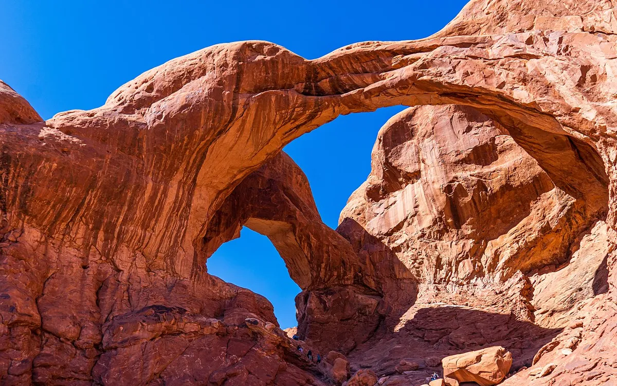 File photo. Photo: OrangeJedi · CC BY 4.0 · Wikimedia Commons
Double Arch
- Easy
- Good for kids
- Dogs prohibited
0.6 mile round tripClimb 30 ftYear-round
A gently sloping path to the base of two arch spans joined at one end. The Park Service says it is the tallest arch in the park, at 112 feet. The path may be accessible to wheelchairs with some assistance. If you scramble up the rock beneath the arches, the park warns, climbing down is often harder than climbing up.
- Arches National Park, The Windows Section · Eastern Utah
 File photo. Photo: David Hiser · Public domain · Wikimedia Commons
The Windows
- Easy
- Good for kids
- Dogs prohibited
1 mile round tripClimb 99 ftYear-round
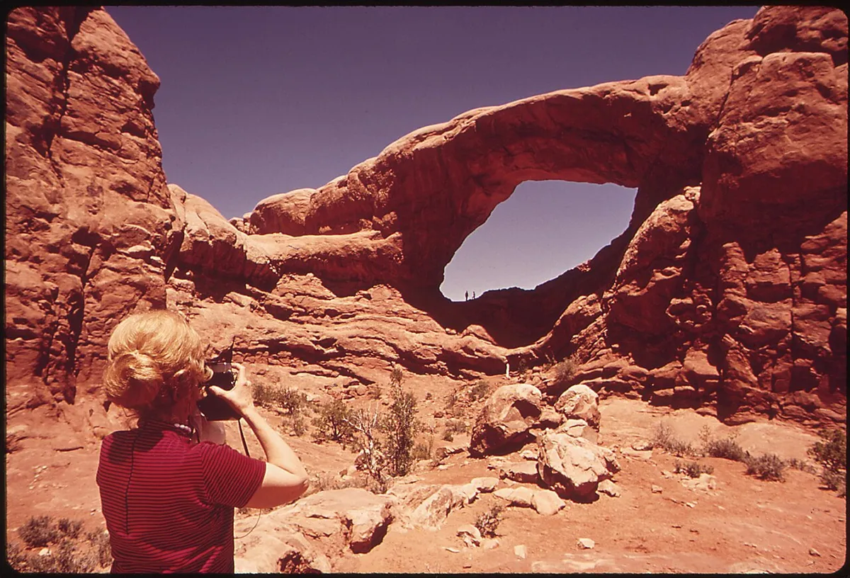
A gentle gravel climb to North Window, South Window and Turret Arch, with a longer primitive loop back that has fewer trail markers and rough steps. Only the first 300 feet are barrier-free; reaching the arches takes a slope and some rock stairs. There is no drinking water at the trailhead. A connector trail links it with Double Arch.
- Canyonlands National Park, Island in the Sky · Eastern Utah
 File photo. Photo: Farragutful · CC BY-SA 4.0 · Wikimedia Commons
Mesa Arch
- Easy
- Good for kids
- Dogs prohibited
About 0.7 mile loopClimb About 80 ftYear-round
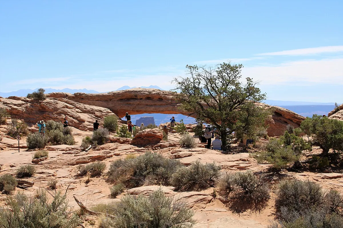
A short loop to an arch on the very edge of a cliff. At sunrise, light bounces off the cliff below and turns the underside of the arch bright orange, framing the La Sal Mountains.
- Canyonlands National Park, Island in the Sky · Eastern Utah
 File photo. Photo: Farragutful · CC BY-SA 4.0 · Wikimedia Commons
Grand View Point
- Easy
- Good for kids
- Dogs prohibited
About 2 miles round tripClimb About 50 ftYear-round
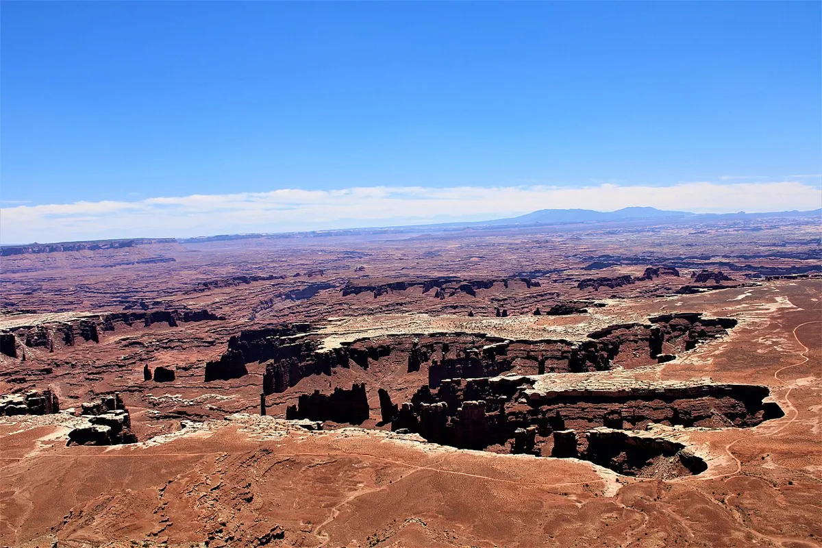
A flat rim walk to the tip of the Island in the Sky mesa, with views over the White Rim and the canyons of the Green and Colorado rivers. One of the biggest views in Utah for the least effort.
- Off SR-128 northeast of Moab · Eastern Utah
 File photo. Photo: BLMUtah · Public domain · Wikimedia Commons
Fisher Towers
- Moderate
- Dog policy not recorded
About 4.4 miles round tripClimb About 700 ftOctober to May; hot in summer
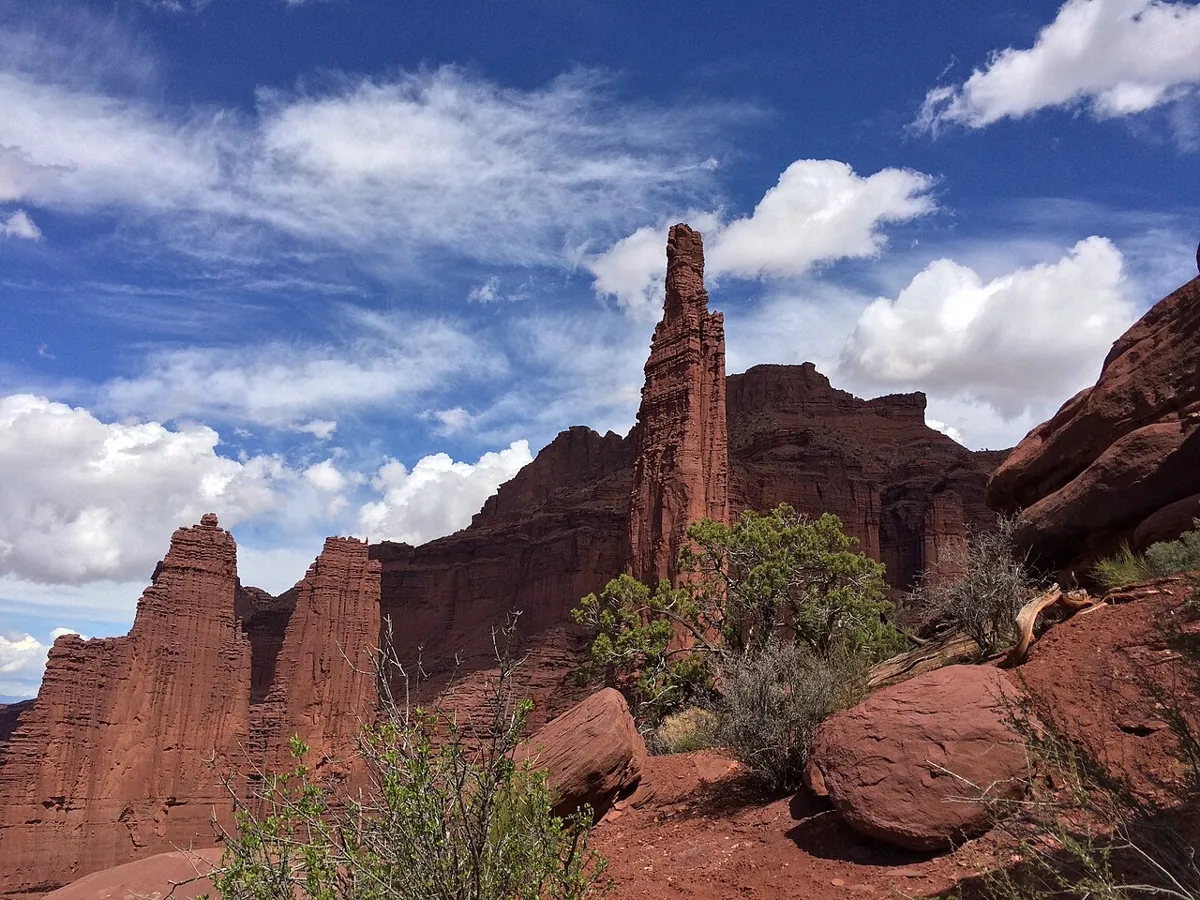
A rolling trail weaves under dark red mud-and-sandstone towers, including the 900-foot Titan, with climbers often on the spires above. It ends at a ridge view across the Colorado River country.
- Off Potash Road (SR-279) near Moab · Eastern Utah
 File photo, 2020-05-16. Photo: Whitimeg · CC BY-SA 4.0 · Wikimedia Commons
Corona Arch
- Moderate
- Dog policy not recorded
3 miles round tripClimb About 450 ftYear-round; avoid midday in summer
Register at the box by the railroad, cross the tracks and follow cairns over slickrock to the base of Corona Arch. The BLM calls it moderately strenuous, with a few sections of mild exposure to heights where safety cables, cut steps and a short ladder help. The arch is on BLM land outside Arches National Park, there is no fee, and roped activities on the arch are prohibited.
- San Rafael Swell, near Goblin Valley State Park · Eastern Utah
 File photo. Photo: Fabio Achilli · CC BY 2.0 · Wikimedia Commons
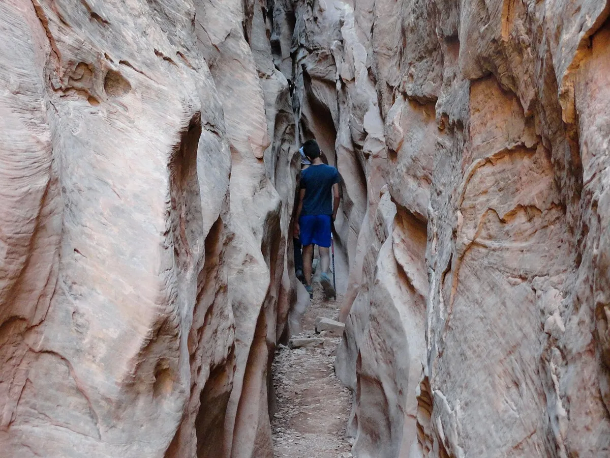
Little Wild Horse Canyon
- Moderate
- Dogs allowed
About 3.5 to 4 miles out and back, or an 8-mile loop with Bell CanyonClimb About 650 ft on the loopMarch to May and September to November
One of the most accessible slot canyons in Utah, with long stretches just shoulder-wide and walls of swirling sandstone. The BLM notes a few scrambles and water that can mean wading, and warns the canyons have extreme potential for flash floods: avoid them if rain is possible. Leashed dogs are allowed.
- High Uintas Wilderness, from Henrys Fork · Eastern Utah
 File photo. Photo: John Sowell · CC BY-SA 4.0 · Wikimedia Commons
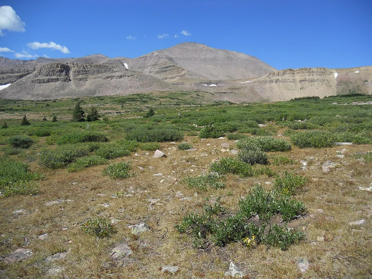
Kings Peak
- Very hard
- Dogs allowed
About 28 to 29 miles round tripClimb About 4,500 ftJuly to early September
The highest point in Utah at 13,528 feet. Most people backpack in over two or three days, camp near Dollar Lake and summit via Gunsight Pass and Anderson Pass, finishing on a boulder ridge. Afternoon thunderstorms are routine; be off the top by noon.
- Mount Timpanogos Wilderness, American Fork Canyon and Provo Canyon · Utah County
 “Mount Timpanogos from the saddle”. File photo, August 28, 2011. Photo: Brian Smith · CC BY-SA 3.0 · Wikimedia Commons
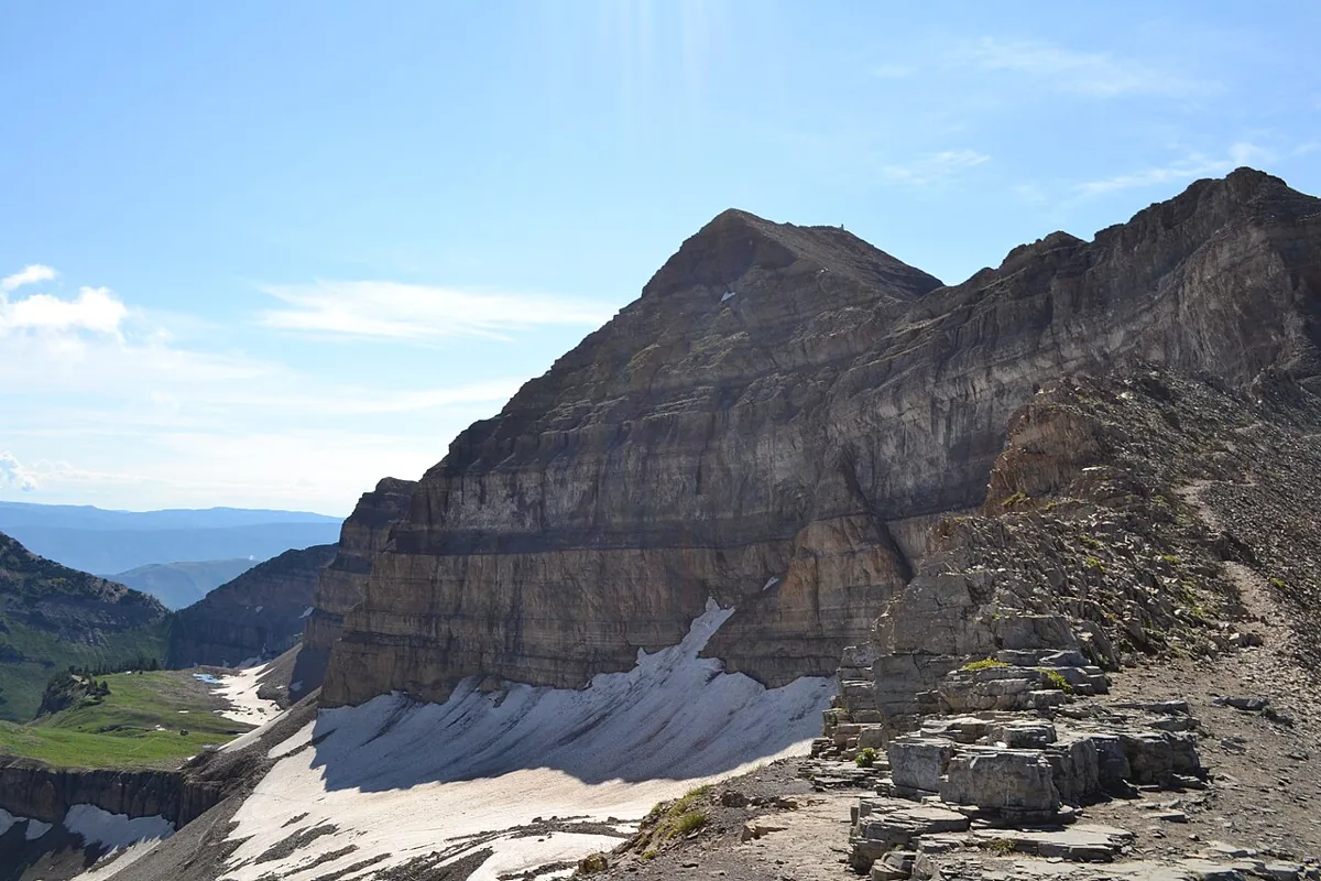
Mount Timpanogos
- Very hard
- Dog policy not recorded
About 14 to 15 miles round tripClimb About 4,500 to 4,900 ftMid-July to September
The mountain over Utah Valley, climbed from Timpooneke in American Fork Canyon or Aspen Grove above Sundance. Both trails pass waterfalls on the way to Emerald Lake and the summit ridge at 11,752 feet. The Forest Service warns that snow covers the trails until midsummer and that sliding down the snowfield above Emerald Lake is dangerous. Start early to be off the top before afternoon storms.
Permit: A recreation pass is required to park at either trailhead. At Timpooneke, parking on summer Saturdays, Sundays and holidays also needs a timed ticket from Recreation.gov. Check current rules before you go.
- Aspen Grove, near Sundance · Utah County
 File photo, June 1, 2016. Photo: An Errant Knight · CC BY-SA 4.0 · Wikimedia Commons
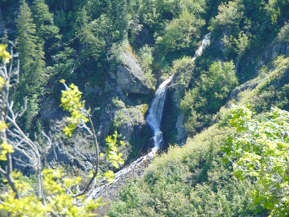
Stewart Falls
- Moderate
- Dogs allowed
About 3.5 miles round tripJune to October
A trail through pines and aspens below Mount Timpanogos to a two-tiered waterfall, starting to the right of the restroom at the Aspen Grove trailhead. The Utah Office of Tourism calls it moderate, with several climbs, and especially pretty in autumn. Aspen Grove is a fee site, and dogs must be leashed.
- Timpanogos Cave National Monument, American Fork Canyon · Utah County
 File photo. Photo: RuggyBearLA · CC BY 2.0 · Wikimedia Commons
Timpanogos Cave Trail
- Hard
- Dogs prohibited
3 miles round tripClimb 1,092 ftSummer, when cave tours run
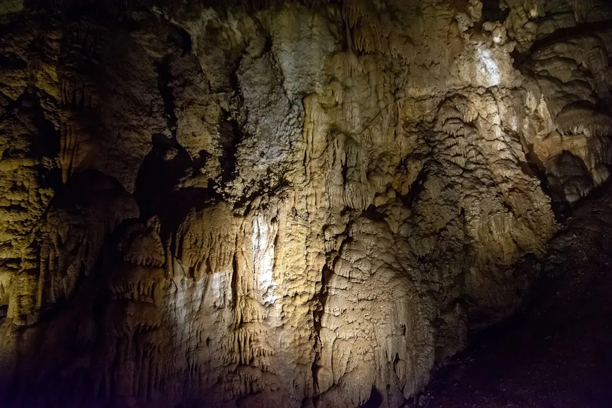
A paved trail climbs 1.5 miles up the canyon wall to three caves, Hansen, Middle and Timpanogos, linked by tunnels and full of helictites and other formations. The Park Service calls the climb strenuous, warns of steep drop-offs and summer heat over 100 degrees, and does not allow strollers or wagons. The hike and tour take about 3.5 hours; the caves stay around 45 degrees.
Permit: Everyone entering the caves needs a tour ticket, infants included. Tours often sell out days or weeks ahead; tickets go on sale 30 days in advance.
- Lone Peak Wilderness, from Silver Lake Flat · Utah County
Silver Lake (American Fork Canyon)
- Moderate
- Dog policy not recorded
About 4.4 miles round tripClimb About 1,400 ftLate June to October
From Silver Lake Flat Reservoir, a steady climb through aspens and over a rocky bench ends at a granite-ringed lake under the ridges of the Lone Peak Wilderness. Push on to Silver Glance Lake for more solitude.
- Pleasant Grove · Utah County
 File photo, 2017-07-05. Photo: An Errant Knight · CC BY-SA 4.0 · Wikimedia Commons
Battle Creek Falls
- Easy
- Good for kids
- Dogs allowed
About 1.5 miles round tripClimb About 450 ftYear-round; best in spring runoff
A quick climb from the east edge of Pleasant Grove to a waterfall spilling over a rock ledge. It is close to town and good for an after-dinner hike with kids.
- Provo, from the Rock Canyon trailhead · Utah County
 “Rock Canyon trail”. File photo, 2018-09-14. Photo: Ben P L · CC BY-SA 2.0 · Wikimedia Commons
Rock Canyon
- Hard
- Dog policy not recorded
3.4 miles one way to the Squaw Peak road; turn around anywhereSpring to fall
The Rock Canyon Trail climbs steadily up a rugged canyon under jagged peaks on Provo’s east side, crossing the stream several times. The Forest Service lists grades of 10 to 25 percent and heavy use by hikers, riders and rock climbers, so expect company.
- Diamond Fork Canyon, Spanish Fork Canyon · Utah County
Fifth Water Hot Springs
- Moderate
- Dogs allowed
About 4.5 miles round tripClimb About 600 ftYear-round; longer in winter when the road closes
A gentle trail along a creek leads to milky blue travertine pools fed by hot springs, with waterfalls just above. The springs smell of sulfur, and the pools are crowded on weekends.
- Mount Nebo Wilderness, from the Nebo Loop Road · Utah County
Mount Nebo
- Very hard
- Dog policy not recorded
About 8 to 9 miles round tripClimb About 3,500 ftJuly to September
The highest peak in the Wasatch Range, at 11,928 feet. The trail from the Nebo Loop Road crosses a high bench, then climbs a steep ridge with loose rock and a narrow, exposed finish to the summit.
- Lehi to Orem, along the foothills of Utah Valley · Utah County
Murdock Canal Trail
- Easy
- Good for kids
- Dogs allowed
About 17 miles one way; ride or walk any pieceClimb Mostly flatYear-round
A paved trail on top of a buried canal that runs through Lehi, Highland, American Fork, Pleasant Grove and Orem. Expect views of Timpanogos, parks and trailheads every mile or two, and lots of bikes, strollers and dog walkers.
- Big Cottonwood Canyon · Salt Lake County
 File photo, September 17, 2020. Photo: Leijurv · CC BY-SA 4.0 · Wikimedia Commons
Donut Falls
- Easy
- Good for kids
- Dogs prohibited
About 1.5 to 3.5 miles round trip, depending on which lot is openClimb About 250 to 500 ftJune to October
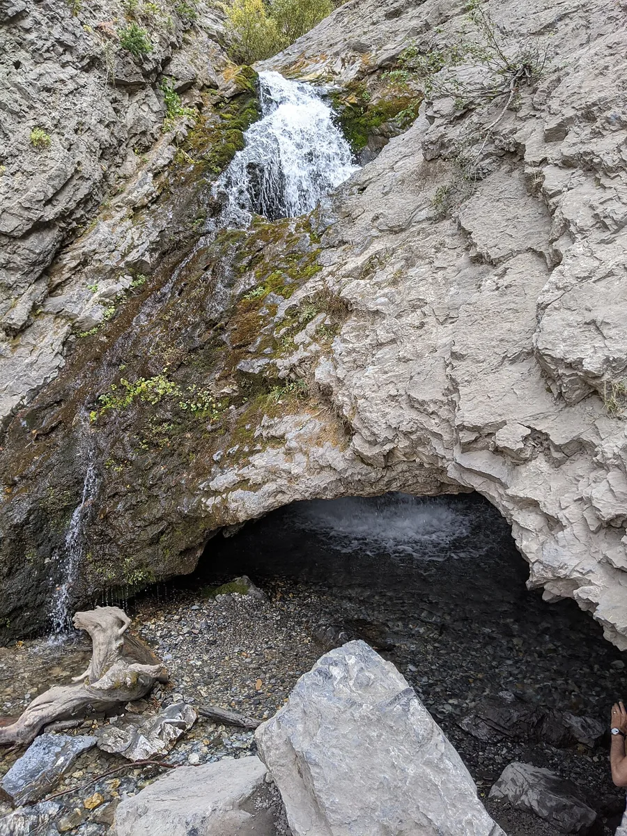
A short hike through the trees to a waterfall that pours through a hole in the rock roof of a small cave. The rocks at the falls are slick; good shoes help.
- Big Cottonwood Canyon, Twin Peaks Wilderness · Salt Lake County
 File photo, June 16, 2018. Photo: Z3lvs · CC0 · Wikimedia Commons
Lake Blanche
- Hard
- Dogs prohibited
About 7 miles round trip from Mill B SouthClimb About 2,560 ft (Forest Service figure)June to October
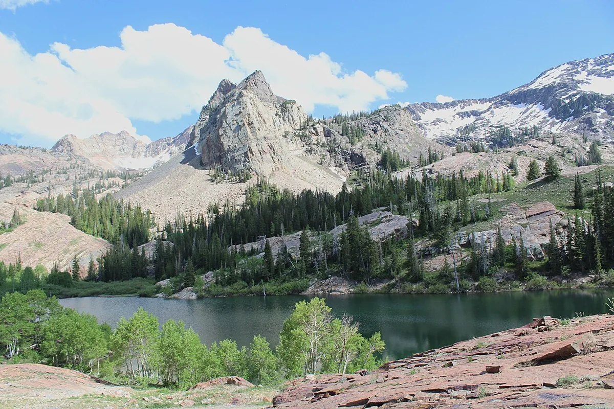
A steep, steady climb from the Mill B South trailhead into the Twin Peaks Wilderness, ending at a lake under Sundial Peak among glacier-polished quartzite, with Lakes Florence and Lillian just beyond. It is in the Salt Lake City watershed: no dogs at all, not even in the car, and no swimming.
- Albion Basin, Little Cottonwood Canyon · Salt Lake County
 “Cecret Lake”. File photo, 2009-07-30. Photo: aspidoscelis · CC0 · Wikimedia Commons
Cecret Lake
- Easy
- Good for kids
- Dogs prohibited
About 1.6 miles round tripClimb About 450 ftJuly to September
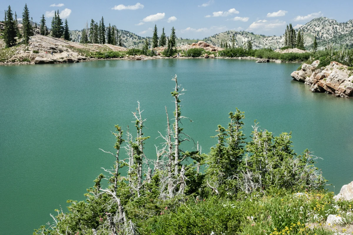
A short climb from Albion Basin to a rock-ringed lake under Sugarloaf Peak. In late July the basin explodes with wildflowers, and moose and marmots are common.
- Brighton, Big Cottonwood Canyon · Salt Lake County
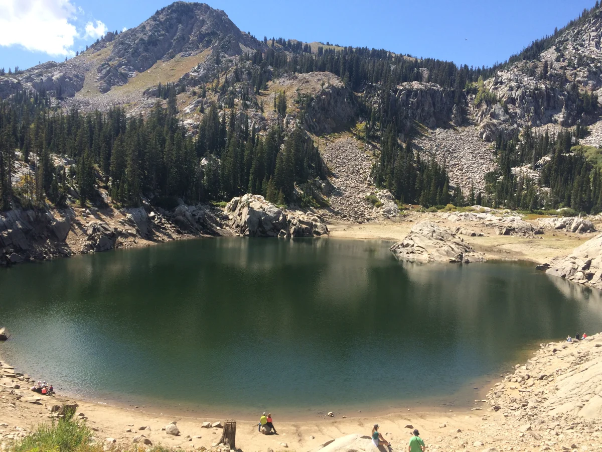 “Lake Mary, Brighton Resort Utah”. File photo, 2016-09-05. Photo: RachLWard · CC BY-SA 4.0 · Wikimedia Commons
Lake Mary
- Moderate
- Good for kids
- Dogs prohibited
About 2.5 miles round tripClimb About 800 ftJuly to October
From the Brighton base, the trail climbs beneath the ski lifts to a lake ringed by granite and pines. Continue to Lake Martha and Lake Catherine for a longer outing.
- Salt Lake City · Salt Lake County
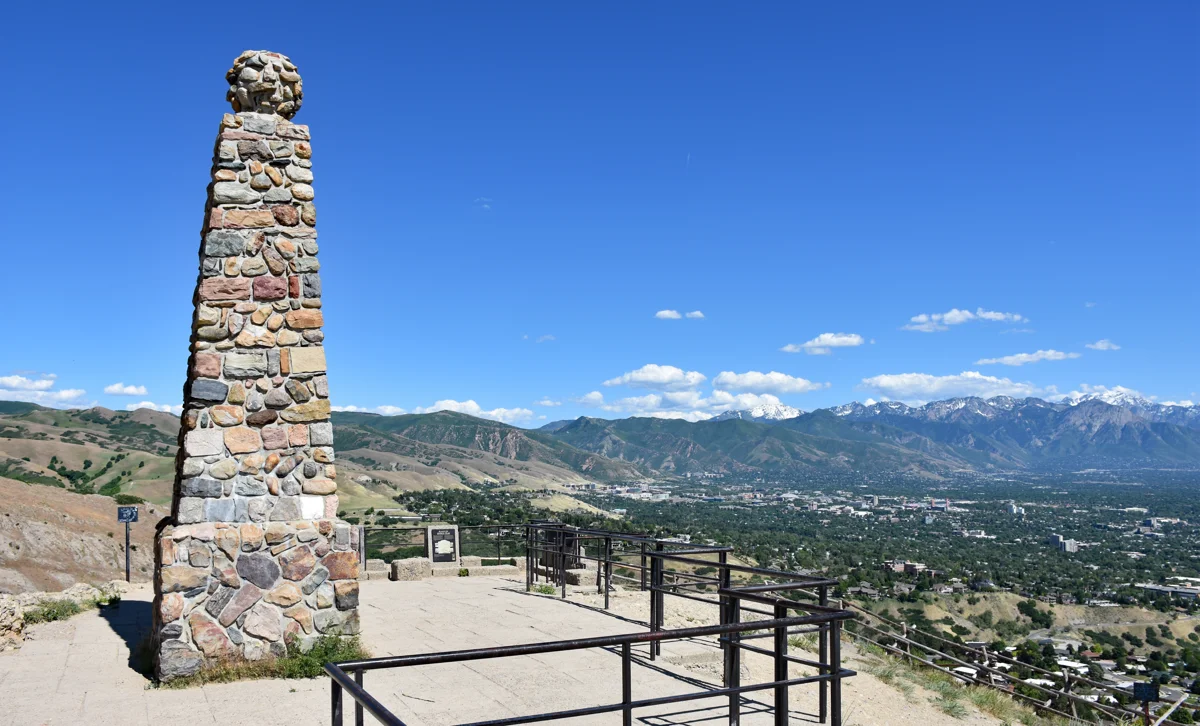 “Ensign Peak monument - Salt Lake City, Utah - 10 June 2020”. File photo, 2020-06-10. Photo: Beneathtimp · CC0 · Wikimedia Commons
Ensign Peak
- Easy
- Good for kids
- Dogs allowed
About 1 mile round tripClimb About 400 ftYear-round
A short, steep climb from a neighborhood above the Capitol to the knoll where Brigham Young and pioneer leaders looked over the valley in 1847. Sunset views take in downtown, the Great Salt Lake and the Oquirrhs.
- Sandy, Lone Peak Wilderness · Salt Lake County
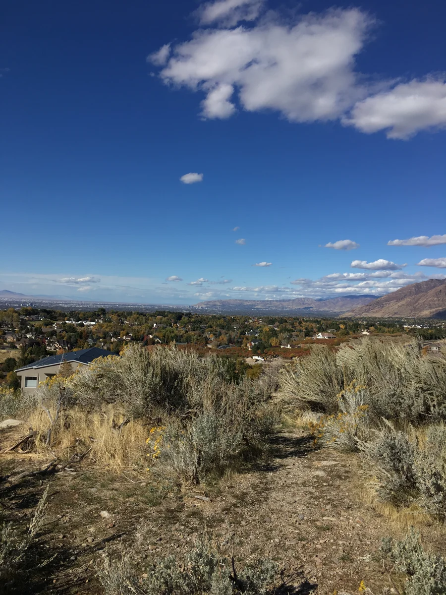 “Bells Canyon, Uinta-Wasatch-Cache National Forest, Utah 01”. File photo, 2019-10-18. Lower canyon view. Photo: JacquesDemien · CC0 · Wikimedia Commons
Bells Canyon
- Moderate
- Dog policy not recorded
About 4.5 miles round trip to the lower fallsClimb About 1,500 ftMay to October
A steady climb past a small reservoir to a canyon of granite slabs and the lower falls. Strong hikers continue to the upper falls, much steeper and less traveled.
- Holladay and Mount Olympus Wilderness · Salt Lake County
Mount Olympus
- Very hard
- Dog policy not recorded
About 6.5 to 7 miles round tripClimb About 4,100 ftMay to October; very hot in midsummer
The rocky peak behind Salt Lake’s east side, climbed by a dry, steep trail and a final scramble up a granite gully. Few hikes in the Wasatch gain this much in so short a distance.
- Wasatch Front foothills · Salt Lake County
Bonneville Shoreline Trail
- Easy
- Good for kids
- Dogs allowed
Varies; pick any segmentYear-round
A long, still-growing trail that follows the shoreline of ancient Lake Bonneville along the foothills. The stretches above the University of Utah and Red Butte offer easy access, valley views and sunrise light on the city.
- Ogden, from the 29th Street trailhead · Northern Utah
Waterfall Canyon
- Moderate
- Dogs allowed
About 2.5 miles round tripClimb About 1,100 ftSpring to fall; best in spring runoff
A steep, rocky trail climbs from Ogden’s east bench to a 200-foot waterfall in a narrow canyon. The last stretch is a boulder scramble.
- Logan Canyon · Northern Utah
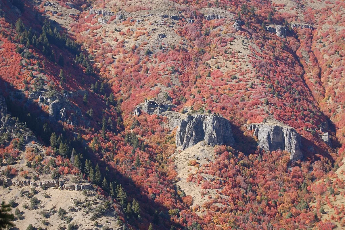 File photo. Photo: A. E. Crane, U.S. Department of Transportation · Public domain · Wikimedia Commons
Wind Caves
- Moderate
- Dogs allowed
About 3.6 miles round trip (1.8 miles each way)Climb About 1,000 ftYear-round; best March through November
From a trailhead about 7.5 miles up Logan Canyon, the trail climbs the limestone north wall to a cave and arch with a skylight, also called the Witch’s Castle. Despite the name, the Utah Geological Survey says water, not wind, formed it underground before the canyon cut down and exposed it. The climb is very steep in places with little shade, and dogs must be leashed.
- Layton · Northern Utah
 File photo, 2019-10-16. Photo: JacquesDemien · CC0 · Wikimedia Commons
Adams Canyon
- Moderate
- Dogs allowed
About 3.7 miles round tripClimb About 1,100 ftSpring to fall
Sandy switchbacks lead to a creek in a shady canyon and a 40-foot waterfall. Popular with families on summer evenings.
- Antelope Island State Park · Northern Utah
 File photo, 2005-11-06. Photo: Leaflet · Public domain · Wikimedia Commons
Buffalo Point
- Easy
- Dogs allowed
About 1 mile round tripYear-round
A short climb from the Buffalo Point trailhead to wide views of Great Salt Lake and the wildlife on the island below. Utah State Parks says leashed dogs are welcome.
- Antelope Island State Park · Northern Utah
Ladyfinger Point
- Easy
- Good for kids
- Dogs allowed
About 0.5 mile round tripYear-round
A short walk among the rocks by the lake that Utah State Parks calls a great trail for young families. Leashed dogs are welcome.
- Mirror Lake Highway, Uinta Mountains · Summit & Wasatch
 File photo, 2008-07-02. Photo: Glennfcowan · CC BY-SA 3.0 · Wikimedia Commons
Bald Mountain
- Moderate
- Dog policy not recorded
About 2.6 miles round trip (1.3 miles each way)Climb About 1,230 ft, from the 10,715-ft pass to the 11,943-ft summitJuly to September
A switchbacking climb up the open south ridge from Bald Mountain Pass, 29 miles east of Kamas on the Mirror Lake Highway, to a summit with views of Hayden and Agassiz peaks and the lakes below. Thin air makes it harder than the distance suggests. The trailhead is in a national forest fee area.
- Mirror Lake Highway, Uinta Mountains · Summit & Wasatch
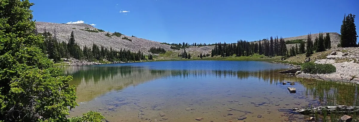 File photo. Photo: Andrey Zharkikh · CC BY 2.0 · Wikimedia Commons
Lofty Lake Loop
- Moderate
- Good for kids
- Dogs allowed
About 4 miles loopClimb About 900 ftJuly to September
A loop past Cuberant Lakes, Lofty Lake and Kamas Lake, with meadows, talus and a high saddle. It is a gentle introduction to the High Uintas from the Pass Lake trailhead.
Planning a Moab trip? Compare these Arches walks
Choose a particular route, not just the name of a trailhead. Arches has short approaches and more demanding extensions in the same area, and the difference matters when time, mobility or a mixed-ability group is a factor.
- Double Arch: a 0.6-mile round trip on a hard-packed, gradually sloping path to the base of the joined spans. NPS calls it barrier-free, though wheelchair users may need some assistance.
- The Windows: the main out-and-back is 1 mile. Reaching the arches means walking up a slope and some rock stairs, and only the first 300 feet are barrier-free. The primitive return is very uneven with fewer trail markers.
- Landscape Arch: 1.8 miles round trip is the shorter Devils Garden outing. Going beyond the arch changes the day, with steep sandstone, narrow ledges and exposure on the longer routes.
- Delicate Arch: a 3-mile round trip, rated strenuous, up exposed slickrock and along a narrow ledge. NPS warns against midday summer heat and says there is no drinking water at the trailhead.
Pick the right arrival point: Landscape Arch starts at Devils Garden, the Double Arch and Windows trailheads are in the Windows area and are linked by a stairway connector, and Delicate Arch hikers start from Wolfe Ranch. Save the park map ↗ before the trip. Advance timed-entry reservations are not required at Arches in 2026, but the park can divert vehicles when areas are congested, so build in flexibility and check current trip-planning information ↗ (checked October 23, 2026). The park recommends at least a gallon of water per person per day.
These four are a starting point, not a list of all hiking around Moab. See all Arches hikes or eastern Utah options, and check each place's own rules: Arches' access and pet rules do not carry over to other land managers.
Official park maps
Download the managing agency’s map before you set out. These are map collections, not live trail-condition reports; check current closures and weather separately.
Hike smart in Utah
Carry more water than you think you need, especially in the desert, where a gallon per person per day is the rule in summer. Never enter a slot canyon when storms are forecast upstream. Start big mountain hikes early to be off summits before afternoon lightning. In the Salt Lake watershed canyons, dogs and swimming are not allowed.